
Taking down the tenements
Why did so many (including Thomson's Mission Hall) have to come down?

In the fifty years to the mid-19th century, Glasgow’s population quadrupled to 345,000. By 1878 it was 500,000, and between 1878 and 1900 it would increase by half as many again, to around three-quarters of a million.
Throughout that century, the building of new homes failed to keep up with the city’s population growth, which meant an ever-larger percentage of families, whether in work or not, pressed more tightly into houses and tenements, most within two miles of Glasgow Cross. When Dr James Chalmers was appointed minister of St Mary Tron parish in 1815, it contained 11,000 people; when he moved to the newly created parish of St John further east in 1819, it was to serve a population of 10,000, largely made up of families of weavers, labourers and factory workers.
One response by Glasgow during the 19th century was to increase its catchment area, absorbing the Gorbals, Grahamston, Anderston, Bridgeton and Calton, among others. The process continued as the century progressed:
In 1891, the independent burghs of Govanhill, Crosshill, Pollokshields East, Pollokshields, Hillhead and Maryhill were brought within Glasgow’s boundaries, along with the districts of Mount Florida, Langside, Shawlands, Kelvinside. Possilpark and Springburn. Kinning Park came in in 1905, and in 1912 the burghs of Govan, Partick and Pollokshaws, as well as the districts of Shettleston, Tollcross, Cathcart, Dawsholm, Temple and North Knightswood1.
However, while this increased the city’s area and population, what it did not do was compensate for the numbers of tenements taken down for redevelopment, or lead to new building sufficient to provide decent housing for those in housing need, especially the poorest.
Some 35 tenements are known to have been designed by Alexander Thomson during his three partnerships, with John Baird II, his brother George, and Robert Turnbull (another eleven are listed as unconfirmed), beginning with an 1852 corner block at 100-116 Taylor Street and 125-135 Parson Street, and ending with Titwood Place in 1876 (now 18-76 Nithsdale Road and 65 Nithsdale Street). Of these, 22 were built south of the Clyde, ten of which were constructed in or adjacent to the Gorbals area of Glasgow. Almost all the latter have disappeared, save for some remnants along Eglinton Street.
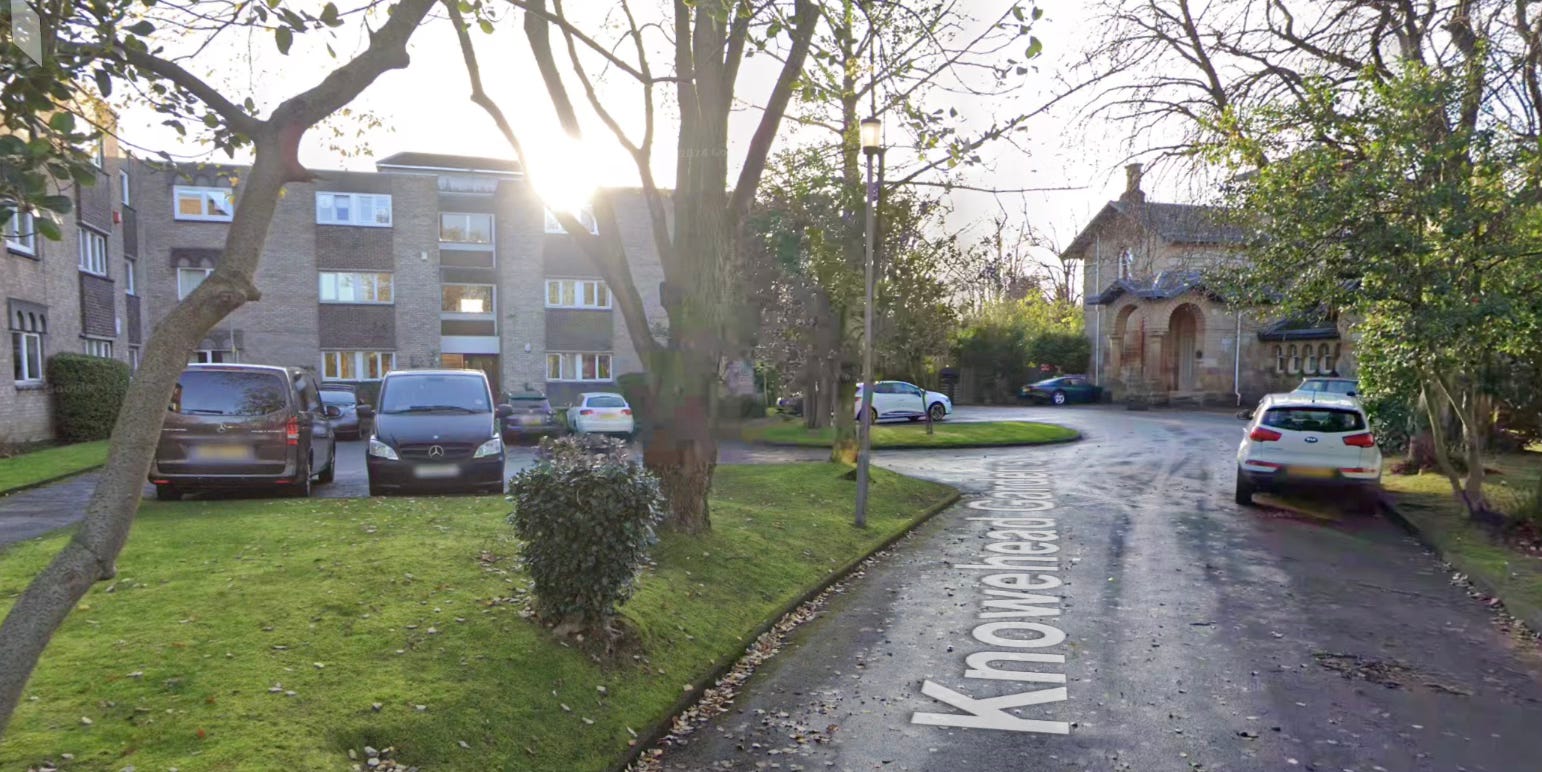
In some cases Thomson’s - and others’ - buildings came down in response to changing housing needs, with stand-alone villas in their own grounds replaced by newer tenements or, later, blocks of flats. The Knowe in Pollokshields, for example, appears to have survived by selling off land within its curtilage for new housing (below).
Others - Queen’s Park Terrace being the most significant example - were demolished to allow for new roads and motorways to be built, but even more came down simply because they were in too poor a condition to survive.
By the 1840s, existing tenements, often dating back to the 18th century, were being carved up, especially in the city centre, to house influxes of new workers and their families, whether from the Highlands or from Ireland. Many lived in lodging-houses created out of what were already outdated flats:
In April 1847 the Police Board was told that in the area around High Street, the Wynds, Saltmarket, Stockwell Street and Bridgegate there were ‘915 lodging-houses, with 2,078 apartments, 2,848 beds, and 3,136 lodgers’. One Board member suggested ‘the return would be more correct if the number of lodgers was multiplied by three’2.
By the 1880s, Glasgow’s Medical Officer of Health was reporting that a quarter of Glasgow families were living in one room, and more than half of those took in lodgers. When the City Improvement Trust began its work, it cleared some 15,000 homes in the heart of the city, but it did not build 15,000 homes to replace them.
Many of the tenements erected in the 1830s, targeting the working classes, had begun to be sub-divided from the start, with no or marginal access to sanitation. The latter was to some extent addressed over time by brick towers added to the backs of tenements, but even some of the tenements designed by Thomson - who was well aware of the effect of poor sanitation - involved the provision of only a shared WC per floor (in other tenements, sometimes less). Tenement overcrowding eventually resulting in a ticketing system stipulating the number of adults and children (counted as half an adult) permitted to sleep there, a system, with accompanying spot-checks by Council workers, that continued into the 1920s.
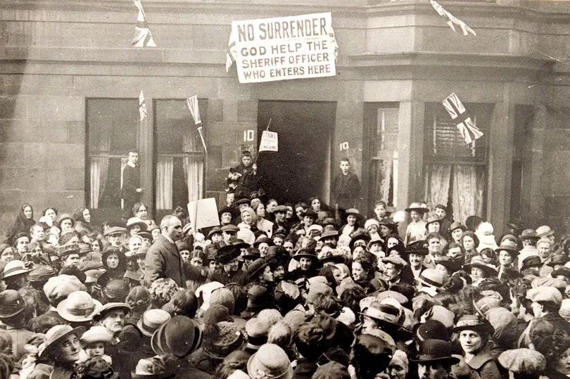
Even where the private owner of a tenement might, by the opening decades of the 20th century, have been willing to invest in improvement, this was unlikely to happen. There was little incentive to do so: it would not lead to any increase in income and in fact might decrease if single-ends, for example, reverted to multi-room flats for a single family. For landlords, the position worsened with the Glasgow rent strike of 1915, when factors acting on their behalf sought to impose a 25% rent increase in response to the housing shortage. When, in March 1915, one landlord sought to evict a woman in response who owed £1 in rent, angry neighbours blocked the street, a situation that repeated itself after September 1915 when rent strikes formally began, led by the Glasgow Women’s Housing Association. At its peak, the rent strike involved some 20,000 households in the city; many other renters paid their original rent, but not the increase.
In November 1915, within a week of Glasgow Council abandoning a case to prosecute 49 tenants for non-payment of rent, Parliament passed the Increase of Rent and Mortgage Interest (War Restrictions) Act, freezing rents at 1914 levels unless landlords could prove improvements had been or were made. By then, however, many tenement owners were the descendants of those who had originally purchased the feu or built the property, and were in no financial position to make improvements, especially in wartime. As for the Act, although intended not to last longer than six months after the end of the war, and gradually weakened over time, sections were not actually repealed until 1989 when rents were deregulated under Margaret Thatcher’s third period in government.
Author Dr Maurice Lindsay states that the Act ‘turned out to be a death warrant for much of Glasgow’s stock of tenements’:
Landlords who had no way of shielding themselves against rises in the cost of repairs brought about by inflation (which, after several decades of more or less stable prices, gathered momentum during World War I) eventually had no money at all to spend on routine maintenance, and the builders’ equivalents of moth and rust were left to do their corrupting will.3
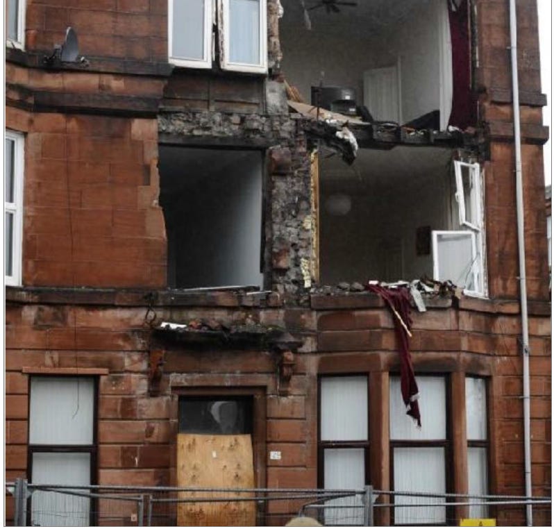
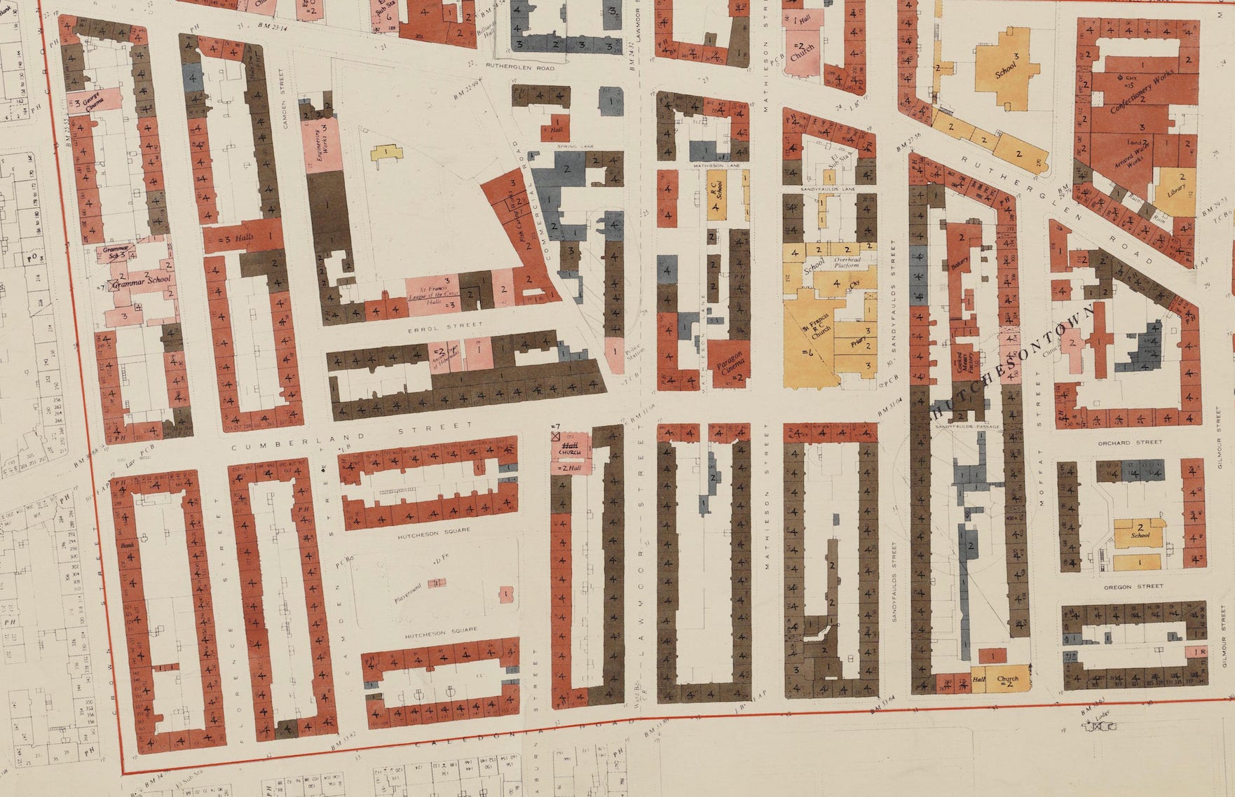
By the mid-1950s, the condition of many tenements, even those built less than eighty years before, was dire. With the creation of post-war Comprehensive Development Areas, Glasgow surveyed its housing stock in terms of condition and sanitation. To date, only the survey for Hutchesontown is online, which contains only one Thomson-designed property, the Mathieson Street Mission Hall. The colour mapping used changes from pale yellow (best) to black (worst), via shades of terracotta and brown: as can be seen below, almost everything in the area surrounding areas the Hall is terracotta (the figures denoting the number of storeys for each building), with the Mission Hall at the corner of Mathieson Street and Rutherglen Road in even worse condition (it may by then have been abandoned).
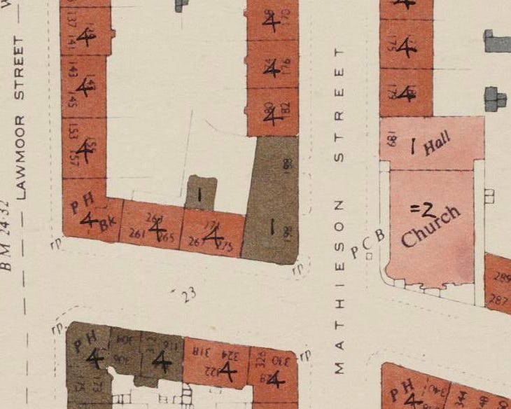
This state of affairs was true for most of Hutchesontown; whether caused by years of maintenance neglect, damp, pollution, or other factors isn’t stated.
In terms of sanitation, CDA mapping used shades ranging from pale green (Class 1: ‘fully acceptable’) through teal (Class 2: ‘capable of improvement to Class 1’), blue-grey (Class 3: ‘incapable of improvement’) and blue-black (Class 4: ‘totally unacceptable’). Almost all of Hutchesontown fell into Classes 3 and 4. It is small wonder that when large-scale demolitions began, Hutchesontown was prioritised.
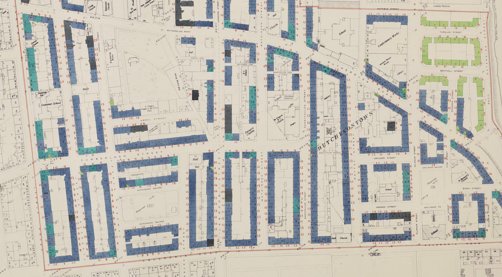
An exception was the three-storey tenements to the east, close to the River Clyde, marked as being Class 1 in terms of sanitation, and Category A in terms of housing condition (below).
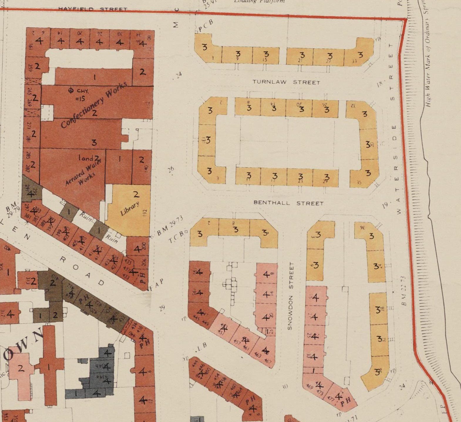
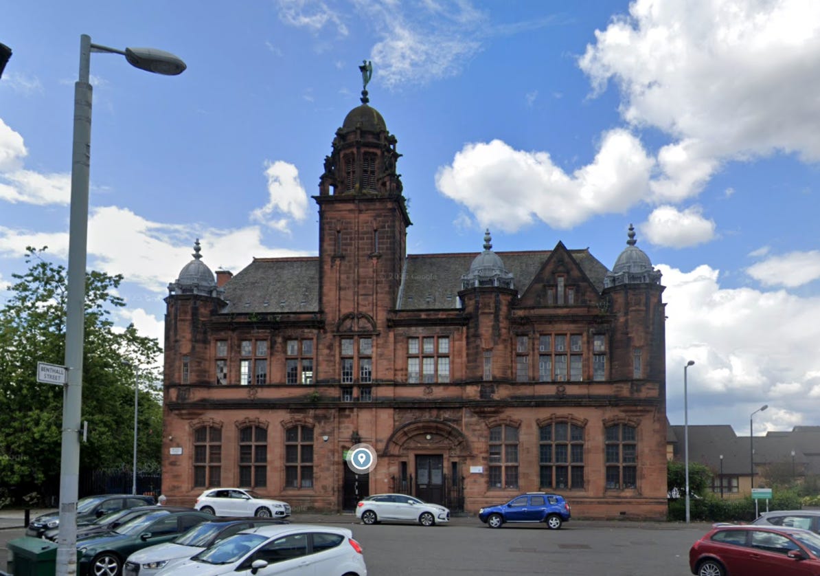
Regardless, they were demolished in anticipation of constructing the eastern element of the new ring road envisaged under the Bruce Plan. Today, the only building on the map remaining in this part of the city is the former Library on McNeill Street (below), now converted into a daycare centre and nursery.
The issues of housing maintenance remain, Scotland-wide. Professor Douglas Robertson’s 2019 report Why Flats Fall Down: Navigating Shared Responsibilities for their Repair and Maintenance, included data from the 2018 Scottish Housing Conditions Survey that indicated three-quarters of pre-1919 housing stock were in a state of Critical Disrepair, one-third in a state of Critical and Urgent Disrepair, and five percent in a state of Critical, Urgent & Extensive Disrepair. The situation for properties built in the inter-war years was not much better, and even a quarter of those built after 1982 were in a state of Critical Disrepair.
Maurice Lindsay, Glasgow (3rd edition), London, 1989
From the Substack article on the Watson Street warehouses.
Lindsay, op. cit.